
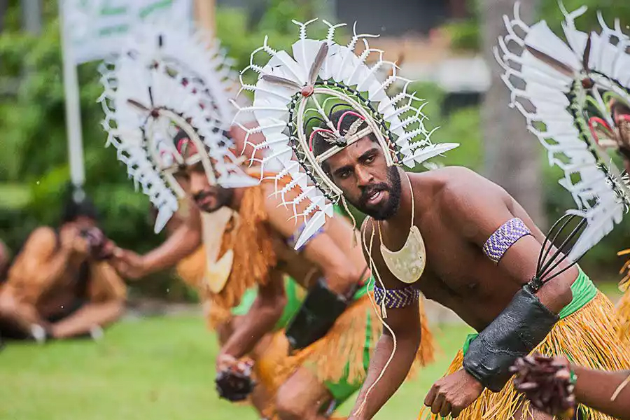
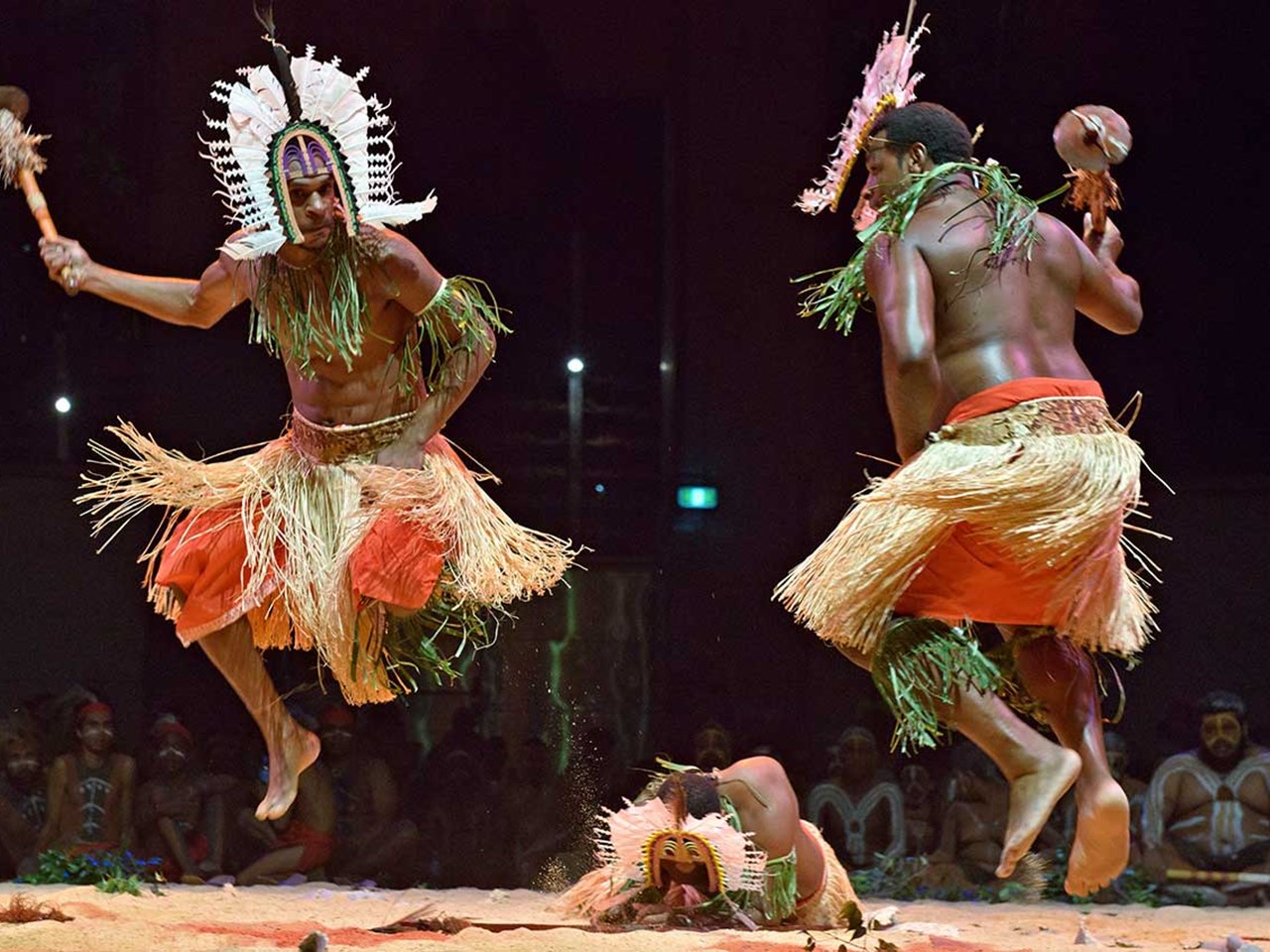
Torres Strait Islander Culture
Posted by Evia Norwood on 12th Sep 2021
What exactly are the differences between Torres Strait Islanders and Aboriginal peoples? Learn about Torres Strait history, who the Islanders are, their languages and about some famous but little-known Islanders.
The Torres Strait and its islands

The Torres Strait is named after a Spanish navigator and captain, Luís Vaz de Torres, who was the first European to sail through Torres Strait in 1606 on his way to Manila in the Philippines, 150 years before Captain Cook. It is the waterway separating far northern Australia (Cape York Peninsula) and New Guinea, between the Arafura Sea in the east and the Coral Sea in the west.
The Torres Strait Islands are a group of about 274 small islands, distributed across an area of around 48,000 km2. At its narrowest point the area extends around 150 km north-south, and at its widest point around 300 km from east to west.
Not all islands belong to Australia, only those that lie within 60 nautical miles (97 kilometres) north from the coast of Cape York.
In August 1770, Captain Cook took possession of Australia's east coast in the name of King George III on Bedanug, an island he named Possession Island. In 1879 Queensland annexed the islands which put them under the control of the same policies of protection and segregation as the rest of Australia.
Without consultation, former prime minister Gough Whitlam in the 1970s proposed to move Australia's northern border with Papua New Guinea south, effectively cutting in half the area of the Torres Strait Islands. But his proposal was unsuccessful, and a new conservative government signed a treaty with PNG in December 1978, maintaining the original border.
Torres Strait Island groups
Culturally, the islands are divided into 5 groups, represented by the five-pointed star on the Torres Strait flag. Each has similar characteristics for geology, formation and location:
Northern islands (also called Top/North Western (Gudamaluilgal) islands). Also known as the hunting islands, they are drier, low-lying larger islands with abundant wildlife, formed by deposition of sediments and mud from New Guinean rivers, close to the southwestern coastline of New Guinea.
Includes: Saibai (Australia's most northerly island, less than 4 kms from PNG), Boigu (Talbot Island), Dauan (Mt Cornwallis Island), Warul Kawa (Deliverance Island).
Western islands (also called Near/Lower Western (Malvilgal) islands). Also known as the rocky islands, they lie south of the Strait's midway point, largely consisting of high granite hills with basaltic outcrops, formed from old peaks of the now submerged land bridge, an extension of the Great Dividing Range.
Includes: Moa (Banks Island), Badu (Mulgrave Island), Mabuiag (Jervis Island), Pulu Islet, Nagi (Mt Ernest Island).
Southern islands (also called Inner (Kaiwalagai) islands). They lie closest to Cape York Peninsula and host most of the population. Some have permanent freshwater springs and have been centres of pearling and fishing industries. Their inhabitants have a strong connection to mainland Aboriginal people.
Includes: Muralag (Prince of Wales Island), Waiben (Thursday Island), Ngurupai (Horn Island), Kiriri (Hammond Island), Bedanug or Bedhan Lag (Possession Island).
Central (Kulkalgal) islands. Also known as the fishing islands, they are widely distributed and most consist of many small sandy cays with little fresh water, surrounded by coral reefs. Some have high basaltic outcrops.
Includes: Aureed (Skull Island), Gerbar (Two Brothers), Iama (Yam Island), Poruma (Coconut Island), Warraber (Sue Island), Masig (Yorke Island).
Eastern (Meriam) islands. Also known as the gardening islands, they are the peaks of former volcanoes with rich and fertile red volcanic soils and thick vegetation. Many have historic fish traps along their coastline.
Includes: Mer (Murray Island), Dauar (Cornwallis Island), Waier Island, Erub (Darnley Island), Ugar (Stephens Island).
Only 17 of the islands are inhabited, and only 20 islands have sufficient fresh water for permanent human settlement.
How many Islanders are there?
Among the Aboriginal and Torres Strait Islander population in 2011, 6% (38,100) identified as Torres Strait Islanders only, while another 4% (25,600) were of both Aboriginal and Torres Strait Islander origin.
But not all Islanders live on the Torres Strait Islands. 64% of them (24,386) live in Queensland, both the mainland state and the islands. Of those, only 28% (6,885) actually live on one of the islands. [9] The remainder (17,501) live in communities along the coast of Queensland, particularly Townsville and Cairns, but also Bamaga and Seisia. This phenomenon is sometimes referred to as the ‘Torres Strait diaspora’.
Most islands have populations of between 100 and 200 people.
Torres Strait Islanders live in all states and territories of Australia, in urban, regional and remote areas, where they might practice their islander culture. The majority live in Queensland and New South Wales, but there are also large communities in Victoria and Tasmania.
Torres Strait Islander culture is also known as ‘Ailan Custom’.
Where did they come from?
More than 8,000 years ago sea levels were about 100 metres lower than today and much of the Torres Strait formed a land bridge between Papua New Guinea and Australia. It helped people move from southern New Guinea to Cape York. Some animal and bird species which live in both Papua New Guinea and North Queensland (e.g. the Spotted Cuscus and Southern Cassowary) are evidence of this connection.
Archaeologists found evidence of human settlement dating back at least 2,500 years, [3][11] but this might change if they discover older sites. Archaeologists agree that evidence may be found in the future that dates settlement up to 4,000 years ago. [12] Like mainland Aboriginal history, Torres Strait Islander history grows both ways, into the future and into the past.
The problem is that older camp sites Islanders made near the shoreline at a time of lower sea levels are now submerged.
The first inhabitants of the Torres Strait are believed to have migrated from the Indonesian archipelago 70,000 years ago.
What languages do they speak?
The two main traditional languages of the Torres Strait Islands are Meriam Mer (spoken in Eastern Islands) and Kala Lagaw Ya (spoken in Near Western Islands).
Meriam Mer is connected to the Papuan languages and has two regional dialects, Mer and Erub. It is the language of the older inhabitants of some of the eastern islands, especially Mer. It is spoken by close to 2,000 Islanders.
Examples: Yawo (goodbye), maiem (welcome), baru (yes), nole (no).
Kala Lagaw Ya, still spoken on the main western islands, is linguistically connected to the mainland Aboriginal languages and has four regional dialects, Mabuyag, Kalaw Kawaw Ya, Kawrareg and Kulkalgau Ya. It is spoken by around 3,000 Islanders.
Examples: Yawa (goodbye), sew ngapa (welcome), wa (yes), lawnga (no).
Torres Strait Creole (or Kriol), also known as Ailan Tok, Yumplatok or Broken (Brokin), is a mixture of Standard Australian English and traditional languages. It developed from pidgin English while missionaries were on the islands in the 1850s. It has its own distinctive sound system, grammar, vocabulary, usage and meaning.
Most Torres Strait Islanders speak Creole, as it helps speakers of the other languages communicate with each other, and each island has its own flavour. Islanders speak Creole in daily life and on some local and regional radio programs. Creole also spread to the Cape York Peninsula with the Islanders’ migration to the mainland.
Sadly, government policies prohibited Torres Strait Islanders from using their traditional languages, just like on mainland Australia, and Islanders lost a lot of culture and language.
Source: www.creativespirits.info